Ongoing transport projects
Plans and proposals for projects which are part of the Connecting Leicester and Transforming Cities Fund programme.
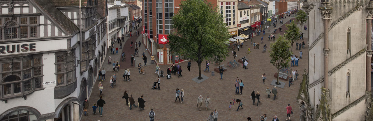
Horsefair Street and Pocklington's Walk
We’re going to improve these streets which form a key route into the city centre from the south and especially for buses. Footways will be widened and segregated cycle facilities provided where necessary. Bus stops and taxi ranks will be relocated and the whole space made more user friendly. The footway and existing carriageway space will be reconstructed to provide improved footways and a contraflow cycle lane, with new paving block materials used along footpaths.
A new path has been formed within Town Hall Square to link to Dolphin Square and the Market.
This scheme is part funded by the European Regional Development Fund and work is due to get underway on Pocklington’s Walk November 2020. The overall improvement scheme will be carried out in phases to minimise disruption, but some road closures will be required. Details will be publicised closer to the start date.
You can see plans and artist impressions below:
You can see the letter of notification issued to residents and businesses, including contact details for the Contractor, below:
The traffic management for latest phase of the works can be seen on the below plan. This phase is due to run from November 2020 to February 2021. Further traffic management plans will be published here as and when they are live.
Market Place South/Dolphin Square
As part of the continuing improvements to the market area, we are going to improve this street to complement the other works that have already taken place. This will include improving facilities for pedestrians and cyclists, and making circulation through the area much easier, especially for pedestrians.
In addition, a building has already been demolished to make a much better visual and physical pedestrian connection between the Market and Town Hall Square through Dolphin Square.
This scheme is part funded by the European Regional Development Fund and works on Market Place South will commence November 2020.
You can see the plan below:
You can see the letter of notification issued to residents and businesses, including contact details for the Contractor, below:
The traffic management for latest phase of the works can be seen on the below plan. This phase is due to run from November 2020 to February 2021. Further traffic management plans will be published here as and when they are live.
St Margaret's Bus Station
St Margaret’s Bus Station will close on 31 December to be demolished and rebuilt as the UK’s first carbon neutral bus station.The new bus station will feature a redesigned layout with increased capacity for national and regional bus services, as well as electric bus charging points and secure storage for 150 bikes.
There will also be improvements to footpaths and roads surrounding the bus station, with better facilities for pedestrians and cyclists, new trees and safer crossings.
Temporary bus stops will be in place whilst the work is carried out. Details can be found on the map below:
Connecting Leicester Neighbourhoods – Beaumont Leys
We are going to upgrade Beaumont Walk and Lismore Walk to ensure these routes are well-connected, accessible and safe for pedestrians and cyclists . The existing path will be widened and resurfaced. Street lighting and signage will also be renewed, where required.
Works will be carried out in phases to minimise disruption, but this means that sections of the path will be closed. Appropriate diversion routes for cyclists and pedestrians will be in place. The first phase will focus on Beaumont Walk between Beaumont Leys Lane and Calder Road. Works are programmed to begin in January 2021.
The scheme is part funded by the Department for Transport Transforming Cities Fund.
Abbey Park Road Improvements
As part of Transforming Cities Tranche 1 we have improved a stretch of Abbey Park Road to create a two-way cycle track.
The cycle track has been created on the opposite side of the road to Abbey Park, and the footpath has also been adjusted.
To make room for the new cycle track, the existing central reservation was removed, and two lanes of traffic maintained.
You can see the plan below:
Clock Tower and Church Gate street improvements
We are planning to pedestrianise an area of the city centre to north of the Clock Tower. We hope to improve access for buses, taxis, cyclists and pedestrians, and support and encourage regeneration in the area. Key features of the plan include:
- Construction of a bus and taxi only road across the former ABC cinema site was completed and the new road named Savoy Street was opened in October 2020.
- Improvements to traffic flow and pedestrian safety on Mansfield Street have also been completed.
- A better pedestrian link between the Haymarket and St Margaret’s bus stations has been provided.
- Works to pedestrianise part of Church Gate, Haymarket and part of Belgrave Gate started on site September 2020 to provide.
- An improved environment to create an area where people feel safe and want to visit.
- A new taxi rank on Belgrave Gate near the theatre steps.
- High quality surfacing to complement the existing city centre pedestrian zone.
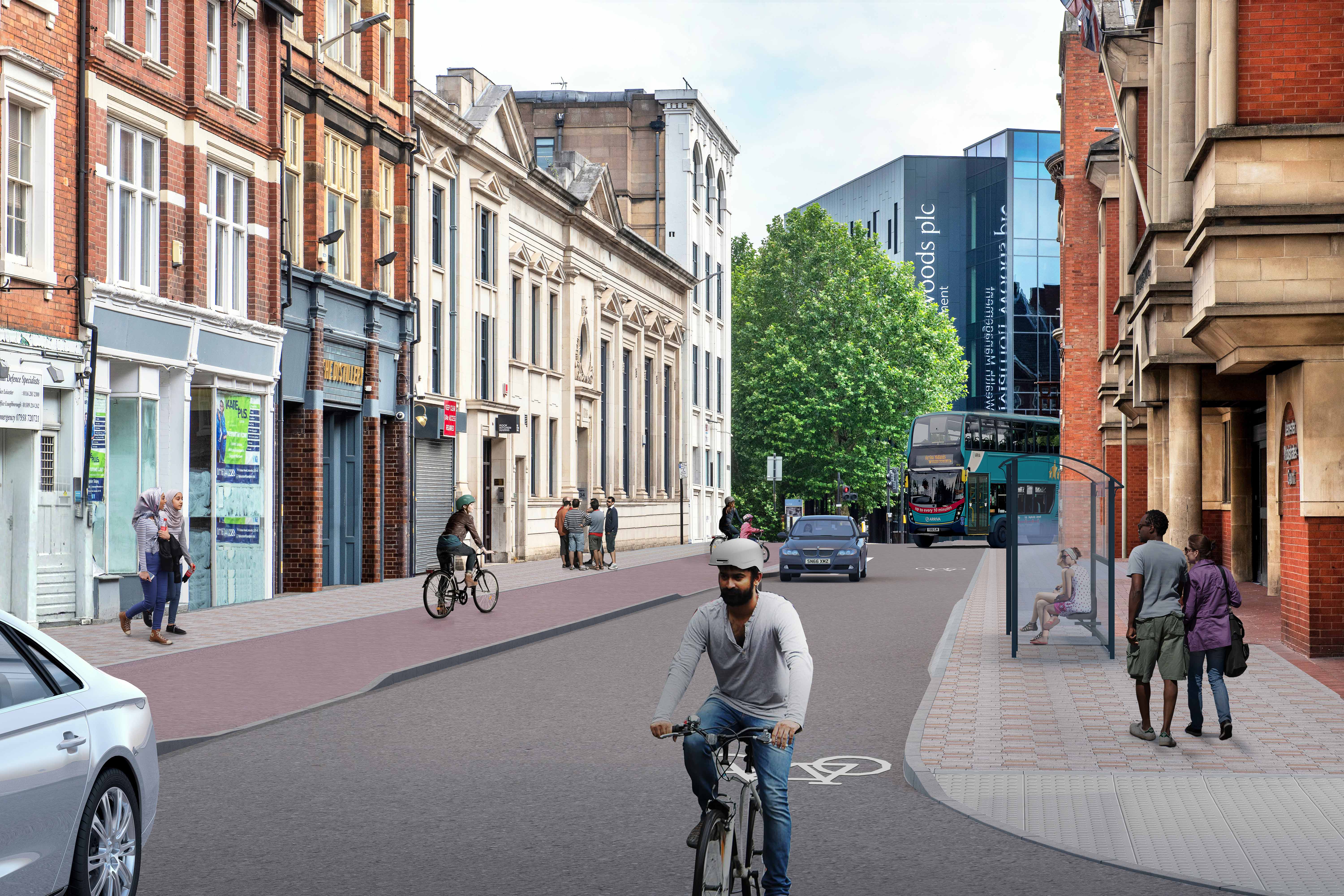
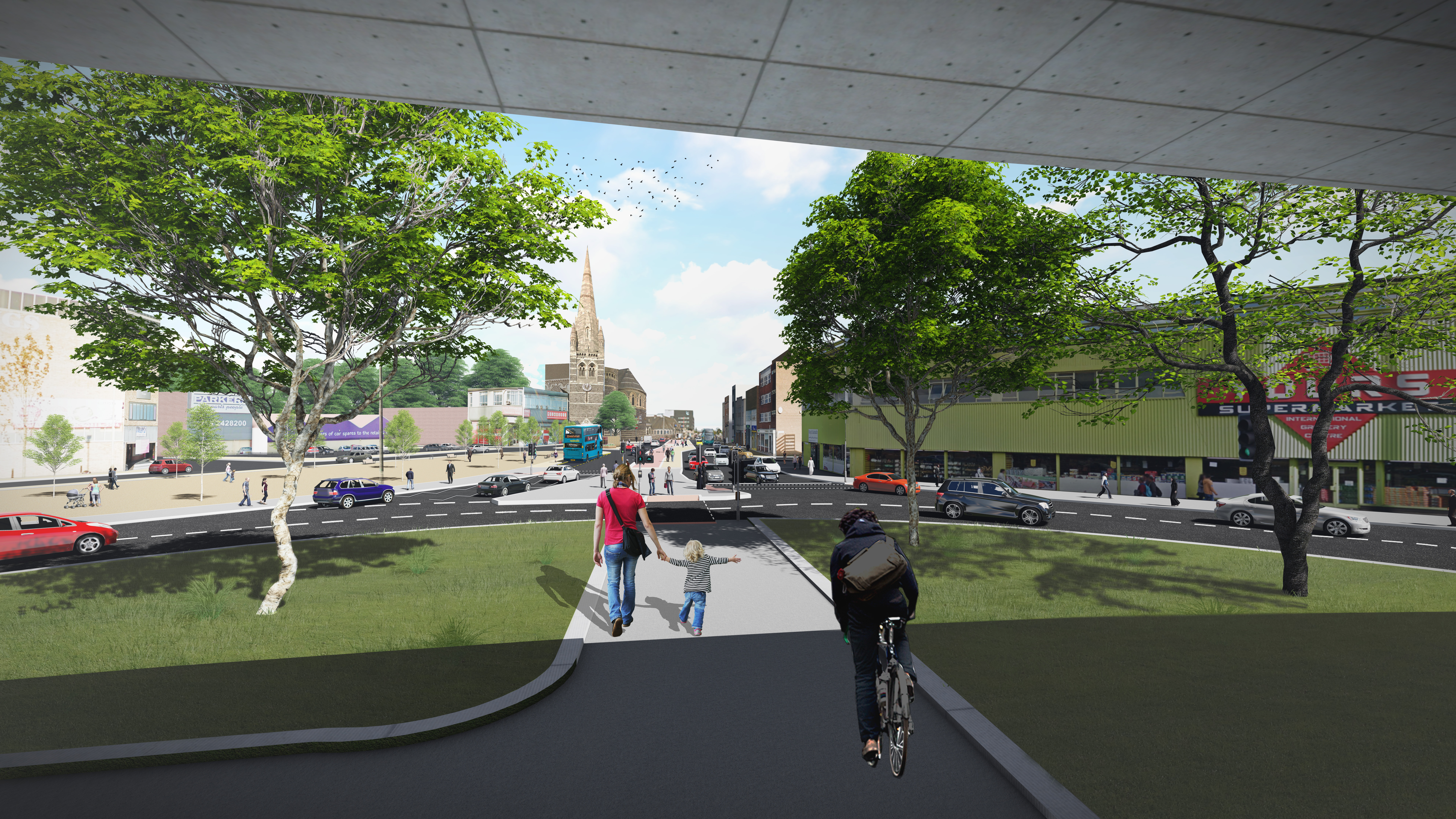
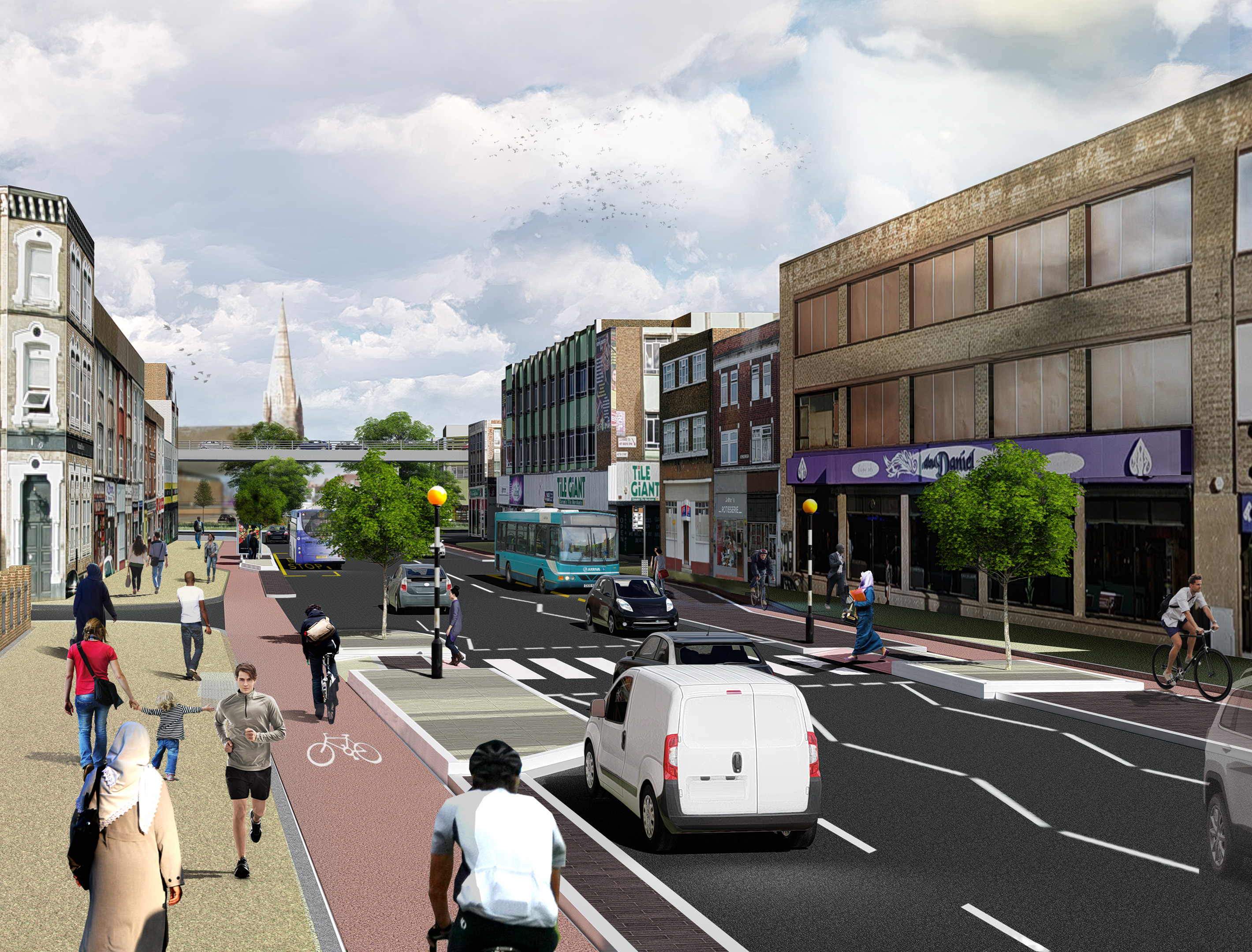
Belgrave Gate improvements
We are on site at present improving the stretch of the road linking Leicester’s Golden Mile to the city centre to create a safer and more attractive route for pedestrians and cyclists along Belgrave Gate, from Haymarket Bus Station to Belgrave Circle.
New off-road cycle lanes on both sides of Belgrave Gate, between Abbey Street and Burleys Way have been created and footpaths reconstructed. The road has been resurfaced and bus stops and new loading bays provided.
Improvements are currently taking place to the Burleys Way roundabout, with a new shared footpath and cycleway running underneath the flyover, proving a more direct and safer route along Belgrave Gate.
The existing Lotus Flowers public art were relocated to nearby Archdeacon Lane next to Charter Street, where a new bridge has been installed to provide an additional entrance into Abbey Park.
North of Burleys Way, a separate cycleway and footpath has now been created along the central reservation, to link in with improvements made to Belgrave Circle following the removal of the flyover.
You can view the plans and artists impressions on the documents below:
- Belgrave Gate north consultation plan (PDF)
- Belgrave Gate north image (JPEG)
- Belgrave Gate south consultation plan (PDF)
- Belgrave Gate south image (JPEG)
- Belgrave Gate north plan 2019 (PDF)
York Road improvements
We’re going to improve the link between King Street, De Montfort University and Bede Park. The improvements include part pedestrianisation of a section of York Road leading onto Oxford Street from Upper Brown Street, and also a part of York Road towards Welford Road. There will still be vehicle access for residents and businesses as part of the proposals. In appearance, York Road will look similar to Silver Street, with the footway will be widened in some sections.
Traffic leaving Newark Street car park will be required to turn left onto Welford Road. Some improvements will be made to the car park itself too.
Bonners Lane will be made a one way towards Oxford Street. Traffic that turns left into Bonners Lane from Oxford Street will be able to access the area by turning left into Grange Lane. The junction between Carlton Street and Oxford Street will be opened to traffic. Alongside this, a segregated cycle way on Grange Lane with new crossing points is also being proposed. Public access will also be improved with new surfaces on the footways and the carriage way.
Work is programmed to begin in March 2019 and take up to five months to complete.
You can see the plan below:
Lancaster Road cycle improvement scheme
The next phase of the Connecting Leicester programme includes a safer and more direct cycle route between the Clarendon Park and the city centre. We are planning to create a new two-way cycle lane from the Queens Road/Victoria Park Road junction across Victoria Park and adjacent to Lancaster Road. The new cycle route is approximately 1km in length.
The new route will link with the recently completed cycle lane on Welford Road, creating a continuous and safer route for cyclists to and from the city centre. The proposals will also see improvements to existing footways and crossing facilities which will also be beneficial to pedestrians.
New cycle paths will be created across Victoria Park adjacent close to the existing footpath connecting Queens Road and Peace Walk, along the full length of Lancaster Road, including a short section through the edge of Nelson Mandela Park. The proposed cycleway on the north side of Lancaster Road between University Road and Tigers Way will be created by installing light segregation. This would segregate cyclists from general road traffic which should encourage cyclists of all abilities to use the cycle provision. The plans will involve the loss of up to approximately 20 pay and display parking spaces on Lancaster Road.
As part of this, Lancaster Road will be made one-way between its junction with De Montfort Street and the ring road. Traffic would no longer be able to turn onto Lancaster Road from Tigers Way.
You can see the proposals below:
Help with documents
Please send us an email to themayor@leicester.gov.uk if you have problems accessing or viewing documents on this page.